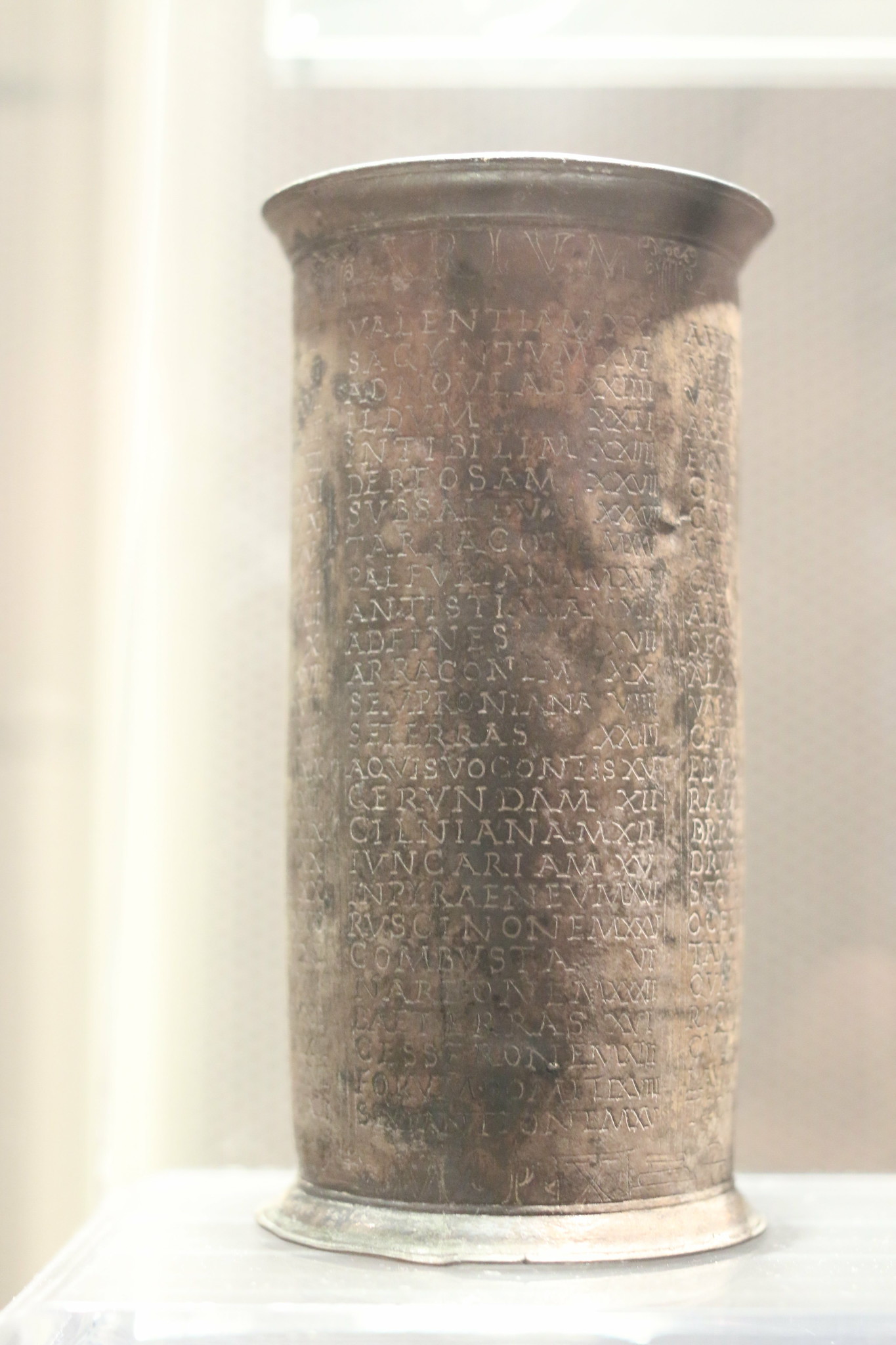
Going around the Empire was quite common. and there were long roads to do that, well maintained and practicable. But there was no SatNav, neither Google maps. Neither cars. Travelers needed to rely on road signs as Miliaria which indicated the distance traveled from a given city, and on itineraria and maps. There are several of this preserved in manuscripts as the Itinerarium Burdigalensis (or Hierosolymitanus) and the Itinerarium Antonini with many itinerary in Britannia and Spain. Itineraria were basically list of cities along a road. Going from one point to the other would have allowed to reach the final destination. A very special itinerarium is the one preserved on the so called Vicarello Beckers, which gives the travel instructions to go from Rome to Gades in southern Spain and back. Needless to say this documents give an extraordinary amount of information about the ancient world and pose also questions such as: what sort of object would have these silver beckers been? would a traveler bring along such itinerary? The information given have been mapped and you can see the road on a map thanks to the work of the Pelagios project and of the members of the pelagios network providing the data.
Links
Related Stories
The Sisenheim church entrance stone.
